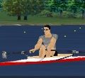
Does anyone know if it is possible to use a PC with GoogleEarth to continuously show the position of my "boat" along some pre-defined path as a row my erg (model D)? This would be very exciting to watch during my training passes and motivate me to keep up my training!
I'm thinking, for instance, that I could define a path along the eastern coast of the US, say between Boston and Miami, and then watch my position move live along this path as I start rowing on my rowing machine. When I stop rowing, a placemark will be entered on my new position, and I will continue from this place next time I start rowing. I know it sounds a bit geeky but, hey, whatever it takes to keep me going is a good thing
/Nick
Nick:
Yes, this should be possible. I am the author of the software that makes the Eh!Team around the world row display in Google Earth, albeit post row.
Google Earth files can be real time. You would then see your progress while you were on your erg. You would of course have to plot your course prior to the row. Google earth and the math are sensitive enough to display a distance of one meter.
I am thinking of making this softwear over the next few months but work and erging cut into my "hobby time". The main difficulty for me will be the interface with the PM3/PM4 monitor, although C2 does make the coding for this available publicly.
If there is more interested in this, let me know and it will stimulate me to get my butt in gear.
Jim